Wednesday, September 30, 2009

CLAY BAY

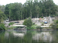
Sept. 30, 2009---Left Prizer Point Marina mid morning on a warm, sunshiny day with calm water. No wind!!


Marina and campground was quiet.


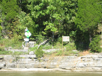
Kentucky State Prison is located on Lake Barkley


Sea gulls followed dream Manor looking for tasty little fish stirred up by the props.


At mile 32.8 on the Cumberland River we turned port to the canal that links Barkley Lake with Kentucky Lake on the Tennessee River. Barkley Lock and Dam could be seen in the distance as we left the Cumberland River. The canal is about 1.5 miles long. The spine of land between the rivers is about 40 miles long and averages 8 miles wide. This peninsula of "Land Between The Lakes" is one of the largest in the Nation. Entering Kentucky Lake we are now traveling upstream, and forward speed decreased about 2 MPH. Increased RPM from 2000 to 2400 to get rate back up to 10 MPH.


Total distance traveled today was 54.3 miles. We crossed the line from Kentucky into Tennessee and went about 5 miles before turning port to Clay Bay. Picked on open area in 10' of water and dropped anchor. A very nice anchorage.

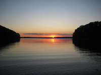
Looking from the bay toward the Tennessee River sunset was delightful.

Tuesday, September 29, 2009

PRIZER POINT MARINA & RESORT


Sept. 29, 2009---Spent the day at Prizer Point Marina & Resort.


In case you are looking for us on a highway map----Look about 10 miles west of the small town of Cadiz, KY. We are on the east side of the Land Between The Lakes where highway 276 tees into highway 274.


Much more than a marina there are all sorts of living quarters for rent. Looks to be a busy place when the weather cooperates.


Windy 50 degrees kept the swimmers at home.


Maryann had a successful day! There is a laundry facility on site.


Sunset behind the trees created an interesting image.


Monday, September 28, 2009

PRIZER POINT MARINA

Sept. 28, 2009---What a long, windy-windy day!


The sun was just beginning to rise above the trees as we left Harpeth River at mile 153.0 and continued down river on the Cumberland.


Reached Cheatham Lock and dam at mile 148.7. Construction on this dam began in 1950 and lake fillage began in late 1953. Maximim width of the dam is 800' and max height is 75'. Lift is 26'.


The first power plant at Cheatham went into operation in 1959.
Lots of water flowing over the dam from all the rain in the past two weeks.


Reached Clarksville at mile 126.


These are structures seen along the river in Clarksville.


There are probably many historic things to see in Clarksville, but for now we just waved as we passed by the RiverCenter.


Tennessee Valley Authority's Cumberland steam plant at mile 103. This plant uses pulverized coal to generate 2.6 gigawatts of electricty, the most of any of the plants on TVA's system..


First class house boat!


Glare made reading the rectangular sign a little difficult. It identifies the Tennesse-Kentucky state line at day marker 74.7 on the Cumberland River.


Just for information a picture of the chart plotter shows Lineport Landing Light and Daymark. It is the black square behind the boat on the right. That is the state line. Notice the water depth is 55.8', speed is 10.9 MPH and the magnetic heading is 338 degrees.


Large old tree leaning in the water.


The wind blew hard all day Often making white caps on Barkley Lake. The current was strong all day. Appeared to average about 2 MPH which really helped on fuel economy and distance covered. Since we got an early start at 6:45 a.m., we chose to travel 98.2 miles and turn starboard at mile marker 54.8 into Hurricane Creek. Prizer Point Marina and Resort is about 1/2 mile up the creek where we tied up at 4:45 p.m. A long 10 hours in the wind and rough water as described by Marryann in the video.

Sunday, September 27, 2009

HARPETH RIVER

Sept. 27, 2009---Sunshine! Left Nashville about 11:00 a.m. The water looked inviting, but there was still lots of debris. Had to maneuver around many large pieces. Current was about 3 MPH.


At mile 189 on the Cumberland River is the Baptist World Center. The large spire is very distinctive.


Apparently because of all the rain, an area behind the trees is overflowing which created a neat waterfall.


Trinity Ashland City, Tennesse. This firm apparently builds large barges. Beams can be seen where the barges are slid into the river.


Not far down river from the town of Ashland City there was a gathering of people in the water. The net is apparently used for some exciting water volley ball. We had noticed the net when we traveled up the river a few weeks ago, but no one was there at the time.


After traveling 38 miles in 4.6 hours we turned port at mile 153.0 to go up the Harpeth River. About half a mile in there is a great open area to anchor. Notice the rode (anchor line) is tight. Current is 1 or 2 MPH keeping the boat rather straight in the river. Water depth is 9', which works well for anchoring.


In the video below I mentioned a 360 view, however it is more like 180 as the sun was too bright to face with the camera.


Saturday, September 26, 2009

TRASH


Sept. 26, 2009---It was raining this morning and the debris coming down the Cumberland River was awesome. An example is the large tree seen in the picture. See the video below for another look.


A couple of fine characters crossing the Shelby Street Bridge.


By 3:00 p.m. the weather had cleared. Notice the water is also free of debris. Sure glad, hope those prop getters are well past!


Looking down on the large boat an alligator appeared quite real. Something to startle passengers!!


Lots of activity along the street.
Many of the clubs have bands playing loud enough that folks stand outside to enjoy the music.


Ate some good barbeque'd pork at Jacks.


Dark clouds in the evening sky made quite a background for downtown Nashville.


Current appeared to be 3 to 4 MPH. Perhaps you can notice movement in the water.

Friday, September 25, 2009

NASHVILLE AGAIN


Sept. 24, 2009---Foggy morning! Having completed all the projects on our to-do list, we are anxious to get on the river. It was about 10:30 a.m. before the fog lifted and we got underway.


Gallatin Marina was clear as we finally pulled away.


Near daymark 228.6 on the Cumberland River, in the area of Gallatin, TN are the remains of a large structure.

This is Johnny Cash's home that burned down April 10, 2007.
For those familiar with youtube---here are two of the many videos available about the home and fire. Just click on the links to view.


Water flowing over the Old Hickory Lock and Dam.


Don't know what they were attempting to lift, but the operation looked interesting. The diver had attached a couple of flotation devices to something under water.


Several pictures of the Dream Manor back in Nashville. Having been there for several days before, it was almost like coming home. There were several boats docked on the city side of the river where power is available.


Not a problem for us to dock on the stadium side. The generator is working great. We shut it down when we are sleeping.


The new props definitely stopped the slight vibration that had been felt on the boat. It is really smooth traveling now!


Entering Old Hickory Lock there was a lot of noise from water flowing over the dam. Flooding upstream caused a need to release water. Notice the fishermen running their boats against the strong current near the base of the falls and floating back rapidly. Looks risky in that violent moving water!